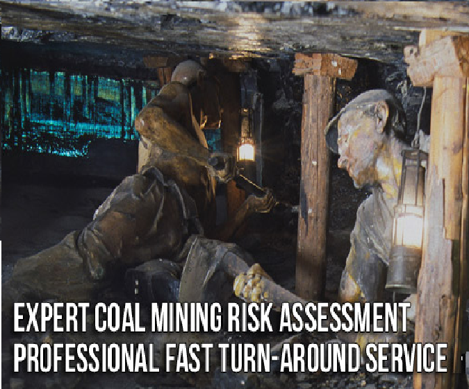
Let Geoinvestigate quote for your next coal mining risk assessment (CMRA), coal mining investigation, mining report, mine shaft investigation, desk study, ground investigation, borehole investigation, site investigation, geotechnical, geo-environmental or contaminated land investigation in Bristol, Bath, Yeovil, Swindon, Bridgewater or Chippenham on or near to the Bristol and Somerset Coalfield.
With over 18 years in the business, several regional offices offering a nationwide service including an office in Solihull, highly qualified and experienced professional staff, and its own drilling equipment, Geoinvestigate is best placed to give the most competitive and professional coal mining service.
If you need assistance with a planning application or a coal mining risk assessment (CMRA), a general site investigation or any of our other services please contact us at one of our regional offices.
Call 0118 4027662 or email enquiries @geoinvesigate.co.uk
If your enquiry is just about Coal Mining CALL FREE on 0800 1712011
The following article gives a brief background to the mining activity in the Bristol and Somerset Coalfields and the investigation services Geoinvestigate provide to enable house buyers, home owners, developers, architects and engineers to build safely in respect of the regions coal mining legacy.
The Bristol and Somerset Coalfields
The Bristol Coalfield is a geologically complex coalfield in the west of England. Comprising the coal-bearing rocks arranged around the Coalpit Heath Syncline and Kingsdown Anticline, it extends beneath the eastern parts of the city of Bristol and northwards through southern Gloucestershire. The coalfield is sometimes referred to together with the Somerset Coalfield, which lies to its south, as the Bristol and Somerset Coalfield. There are also two outlying coal-mining areas, the Severn Coalfield and the Nailsea Basin which are described below.
Several coal seams are named in the sequence in the Bristol Coalfield. The seams are listed stratigraphically with the uppermost (youngest) at the top of the list and the lowermost (oldest) at the foot. Not all seams are named, nor are all seams present at any one location.
Upper Coal Measures (UCM)
- Pensford No 1
- Pensford No 2
- Pensford No 3
- Bromley No 4
- Bromley No 5
- Rock Vein of Brislington
- Salridge
- Mangotsfield (?Salridge)
- Stinking
- Corston
- Cock (?=Millgrit & Rag)
- Coke
- Chick (?=Buff)
- Hen (?=Parrot)
- Coking
Lower and Middle Coal Measures (LCM)
- New Smiths (Yate Little, Wearmley
- Yate Hard
- Lower Five
- Kingswood & Bedminster Great
- Giller Inn
- Kingswood Little
- Soundwell Hard Venture
- Ashton Great
- Ashton Little
Severn Coalfield
Within the Upper Coal Measures of the outlying ‘Avonmouth Basin’ are the Avonmouth No 1 and No 2 coals. This is sometimes known as the Severn Coalfield. It lies several miles to the west of the main Bristol Coalfield and extends under the Severn Estuary as far as Portskewett. It is also largely obscured by thick deposits of estuarine alluvium. Coal was also worked on a very small scale in the rocks of the Clapton-in-Gordano inlier just to the south of the Severn Coalfield.
Nailsea Basin
In the small ‘Nailsea Basin’ 7 miles / 12km to the west of Bristol, a sequence of Coal Measures rocks are preserved within a syncline. These rocks are connected at depth with those of the Somerset Coalfield; though it lies close to the main body of the Bristol Coalfield, it is not connected with it. Two seams are known from the upper Coal Measures and twelve from the Lower and Middle Coal Measures within this ‘basin’.
Upper Coal Measures – Grace’s (0.9m)
Lower and Middle Coal Measures
- White’s Top (1.1m)
- Golden Valley
- Backwell Little
- Dog (0.9m)
The Somerset Coalfield in northern Somerset, England is an area where coal was mined from the 15th century until 1973. It is part of a larger coalfield which stretched into southern Gloucestershire. The Somerset coalfield stretched from Cromhall in the north to the Mendip Hills in the south, and from Bath in the east to Nailsea in the west, a total area of about 240 square miles (622 km2). Most of the pits on the coalfield were concentrated in the Cam Brook, Wellow Brook and Nettlebridge Valleys and around Radstock and Farrington Gurney. The pits were grouped geographically, with clusters of pits close together working the same coal seams often under the same ownership. Many pits shared the trackways and tramways which connected them to the Somerset Coal Canal or railways for distribution.
The Somerset Coalfield covers a total area of about 240 square miles (622 km2). It consists of three synclines, informally referred to as ‘coal basins’. The Pensford Syncline in the north and the Radstock Syncline in the south are separated by the east-west trending Farmborough Fault Belt. Further to the west is the smaller Nailsea Syncline. The Radstock Syncline in particular is cut by a series of east-west thrust faults and north-south trending normal faults.
Coal Seams in the Upper Coal Measures
Forty Yard Coal (Pensford), Withy Mills Coal, Great Coal, Middle Coal, Pensford No 2 Coal, Slyving Coal, Bull Coal, Bottom Little Coal, Rock Coal, Farrington Top Coal, Top Coal, ?Streak Coal, Peacock Coal, Middle Coal, No 5 Coal, ?Bromley No 4 Coal, New Coal, No 7 Coal, No 9 Coal, Big Coal, Brights Coal, No 10 Coal (splitting into Nos 8 & 9 Coals), No 11 Coal, Rudge Coal, Temple Cloud Coal, Newbury No 2 Coal, Newbury No 1 Coal, Globe Coal, Warkey Coal.
Coal Seams in the Upper Coal Measures – Garden Course Coal, Great Course Coal, Firestone Coal, Little Course Coal, Dungy Drift Coal, Coking Coal.
Coal Seams in the Lower Coal Measures – Standing Coal, Main Coal, Perrink Coal, White Axen Coal.
Borehole Investigation of Shallow Coal Mining
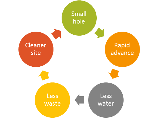
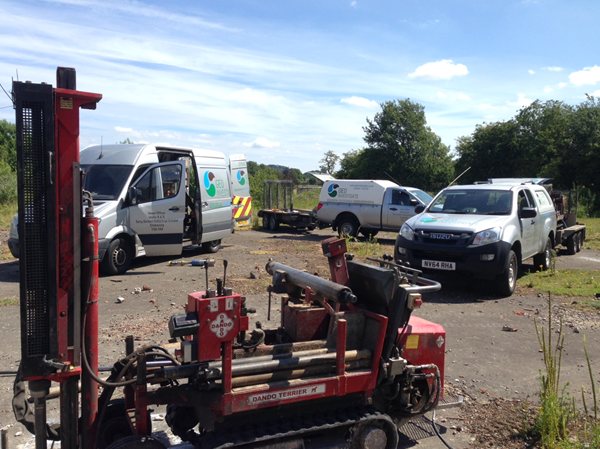
Over the past 5 months Geoinvestigate’s new compact microdrill system has proven its worth and that it’s just the answer for investigating Bristol and Somersets coal mining legacy. Microdrill offers restricted access, small diameter rotary open-hole drilling which is first and foremost SAFE, fast, clean, quiet, cost effective and environmentally friendly. New Microdrill has been designed for probing for shallow workings in limestone, sandstone and coal as well as locating mine shafts and sinkholes.
Recently Microdrill was in action in Newcastle, Co Durham on the Durham and Northumberland Coalfield. Having previously obtained a coal drilling permit from the Coal Authority to drill with water flush Microdrill was delivered to site on the back of a standard flatbed trailer.

Shallow mine working investigation of a housing estate in Newcastle
Access to the drilling positions in several gardens was tricky but achievable with Microdrill.
In accordance with Coal Authority Guidance on Managing the Risk of Hazardous Gases when Drilling or Piling Near Coal (essentially a Code of practice for safe drilling and piling through coal) water flush was in this instance considered to be the safest flushing medium. This is because there was assessed to be an unknown or undetermined gas risk as is so often the case in exploratory drilling works on the UK coalfields.

The Coal Authority normally stipulates small volume water injection flush for their internally managed exploratory drilling works because it ensures minimal risk to the public from hazardous gases including carbon dioxide, methane and carbon monoxide. In fact it is rare under the Coal Authorities strict safety policy for drilling through coal for them to permit anything else but water.

- New Microdrill on it’s 50th job
The Coal Authorities strict policy with regard to water flush is something to be considered by site investigation companies when compiling a Coal Mining Risk Assessment (CMRA) or drawing-up a source-pathway-receptor based risk assessment for drilling permit application.
It should also be borne in mind by drilling contractors and consultants that the CA polices drill sites checking some 10% of drill sites per year to ensure compliance with the permit. A change in drill flush from that originally agreed with the CA would be a breach of terms and conditions and could result in prosecution.
New Microdrill has been demoed to the CA who gave it their nod of approval suggesting that in their opinion it was easily capable of reaching 50m and probably much deeper though up till now it has only been tested to 30m which is typically the limit for shallow mining investigation.
Advantages of Geoinvestigate Microdrill
- Health & Safety makes hand drilling obsolete
- Adjustable mast drilling under buildings, services & obstructions
- Mast guard safe operation even when drilling inclined
- High productivity more metres, more information & less uncertainty
- Water flush safer drilling in mine workings and openings
- Uses less water tidier site and less reinstatement costs
- Smaller hole faster penetration, less solid waste disposal
- Micro drill size access to small spaces + sensitive urban locations

Coal mining Investigation Durham Coalfield. Intact coal turns drill water black

If you require a coal mining investigation, Phase 1 desk study, coal mining risk assessment (CMRA), Phase 2 intrusive site investigation, geotechnical investigation, ground investigation or you need a contaminated land survey or landfill gas survey, trial pitting or borehole drilling please do not hesitate to contact one of our regional offices. Our team are only too happy to assist with your enquiry and will ensure that you get our most competitive quote.